
Maps have been more than just geographical references to places all through their history. Maps have played an important role in exploring uncharted territory, securing vital information, aiding military plans, and even guiding political tactics. The Secret Maps British Library Collection is a good example of how maps have helped uncover interesting tales of discovery and power. The collection proves that, at times, maps were made not only to share but to also keep information from others. By delving into the history of rare maps and stories behind them, people can learn about the effects of geography on world events.
- The History and Purpose Behind Secret Maps
- British Library Maps Collection and the Exhibition Experience
- How Secret Maps Conceal and Reveal the World
- Benefits of Studying Secret Maps and Their Real-World Importance
- Real-Life Examples of Secret Maps Changing History
- Secret Maps Book, Catalogue and Research Value
- Visitor Opinions, Reviews and Why People Choose This Exhibition
- Frequently Asked Questions
- What was the Secret Maps British Library exhibition about?
- Are Secret Maps British Library tickets available?
- What can people discover from the British Library maps collection?
- Is there a Secret Maps book available?
- What information is included in the Secret Maps British Library catalogue?
- Conclusion
The History and Purpose Behind Secret Maps
The history of secret maps is closely connected with the development of exploration, communication, and political power. Long before modern technology existed, rulers and explorers understood that accurate geographic information could provide significant advantages. Knowing the location of important resources, safe routes, or strategic areas could influence the success of an entire mission or campaign.
During periods of exploration, maps became valuable records of discovery. Sailors and explorers created detailed charts showing coastlines, oceans, and unfamiliar regions. However, these discoveries were not always openly shared because governments and organisations wanted to protect their advantages. Information about trade routes, natural resources, and new territories could provide economic and political benefits.
Military organisations also relied heavily on confidential mapping. A detailed map showing landscapes, roads, rivers, and important locations could help commanders make better decisions. For this reason, many military maps were restricted and only available to selected individuals. The accuracy of these maps could influence planning, defence strategies, and the outcome of major events.
Maps have also played an important role in shaping political understanding. Borders, territories, and ownership have often been represented through cartography. The way a region appears on a map can influence how people understand history and identity. This demonstrates that maps are not simply technical documents; they are also reflections of human choices, priorities, and perspectives.
The study of secret maps helps researchers understand how information has been collected, controlled, and shared across different periods. These documents provide evidence of how societies developed methods to manage knowledge and use geography as a tool for decision-making.
British Library Maps Collection and the Exhibition Experience
The British Library maps collection contains a remarkable range of historical materials that demonstrate the evolution of cartography. From early handwritten maps to advanced geographical documents, these collections show how humans have attempted to record, understand, and organise the world around them. Each map represents a different moment in history and provides clues about the people who created and used it.
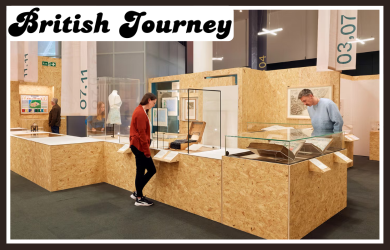
The British Library Secret Maps Exhibition focused on the relationship between maps and hidden information. Instead of presenting maps only as beautiful historical objects, the exhibition explained the reasons behind their creation. Visitors could explore how maps were connected with exploration, military operations, scientific research, and political decisions.
One of the most interesting aspects of the exhibition was the way it showed that maps can both reveal and conceal information. A map might reveal unknown landscapes while hiding strategic details from competitors. It might help one group understand the world while preventing another group from accessing the same knowledge. This balance between sharing and protecting information is what makes secret maps fascinating.
The exhibition also demonstrated how mapping methods changed over time. Earlier maps depended on handwritten measurements, drawings, and observations, while modern mapping uses satellites, computers, and digital systems. Despite these technological changes, the main purpose remains similar: collecting valuable information about places and using that information effectively.
Visitors interested in historical exhibitions often search for details such as secret maps british library tickets because they want to experience rare collections in person. Exhibitions like this attract people from different backgrounds, including students, researchers, tourists, and history enthusiasts who want to explore unusual stories that are not always covered in traditional museums.
How Secret Maps Conceal and Reveal the World
The concept of secret maps: how they conceal and reveal the world explains the unique role these documents have played throughout history. A secret map is not simply a hidden object; it is a record of knowledge that shows what people understood, what they wanted to protect, and what they considered important at a particular time.
Many historical maps contained information that was valuable because of its strategic importance. Some showed military positions, transportation routes, communication networks, or unexplored areas. Protecting this information was necessary because revealing it could create risks or provide advantages to competitors.
However, once the original reasons for secrecy disappeared, these maps became valuable resources for historians and researchers. They allow experts to study past events and understand how people travelled, explored, traded, and organised societies. A map can sometimes reveal details that written records do not explain clearly.
Secret maps also help modern audiences think about information in the digital age. Today, people use online maps, navigation applications, and location-based services every day. While these tools provide convenience, they also raise questions about privacy, ownership, and control of geographic information.
Studying historical secret maps reminds us that information has always had value. The methods may have changed from paper documents to digital databases, but the importance of controlling and understanding location information remains relevant.
Benefits of Studying Secret Maps and Their Real-World Importance
Exploring historical maps provides benefits that go beyond learning about geography. These documents help people understand how societies developed, how decisions were made, and how information influenced important events. The British Library’s historical map resources demonstrate that maps can act as evidence of human experiences, showing the connection between exploration, politics, science, and technology.
One major benefit of studying secret maps is gaining a deeper understanding of history. Written records often explain what happened, but maps can show where events took place and why certain locations mattered. They help researchers identify changing borders, historical movements, trade connections, and the development of cities and landscapes.
Another important advantage is improving critical thinking. Maps are often viewed as objective sources, but historical examples show that they are created with specific purposes. A map may highlight certain information while ignoring other details. Learning how to analyse maps helps people understand that all information has context and should be examined carefully.
Secret maps also provide educational value for students and researchers. They combine different subjects, including geography, history, politics, design, and technology. This makes them useful resources for understanding how different areas of knowledge connect and influence each other.
The importance of studying these maps can be understood through several key areas:
- They reveal historical events and decisions through geographical evidence.
- They explain how exploration and discovery changed human understanding of the world.
- They show how governments and organisations managed valuable information.
- They connect historical mapping methods with modern digital technology.
- They encourage people to think critically about information accuracy and ownership.
These benefits explain why exhibitions focused on hidden cartography continue to attract attention. They provide more than visual displays; they create opportunities to understand the relationship between information, power, and society.
Real-Life Examples of Secret Maps Changing History
Throughout history, secret maps have influenced exploration, military operations, and political decisions. One of the clearest examples comes from exploration periods when countries competed to discover new territories and establish trade connections. Maps created during these journeys contained valuable knowledge about coastlines, resources, and travel routes.
Explorers depended on accurate charts to navigate unfamiliar environments. However, these documents were often treated as important assets rather than ordinary records. Countries that controlled better geographic information could gain advantages in trade and international competition.
Military history also provides many examples of the importance of confidential maps. During conflicts, commanders needed detailed information about landscapes, transportation routes, and strategic locations. A well-prepared map could support planning and help leaders make informed decisions. Because of their importance, many military maps were protected from public access.
Maps have also played a role in humanitarian and scientific work. Geographic information helps organisations respond to natural disasters, study environmental changes, and plan development projects. Although these maps are not always secret, they demonstrate the continuing importance of accurate location-based information.
Modern technology has transformed secret mapping into a digital process. Today, satellite images, geographic information systems, and online databases provide detailed information about the world. These technologies create new opportunities but also raise questions about privacy and control.
The history of hidden maps shows that geography has always been connected with human decisions. Whether created on paper centuries ago or generated through modern technology, maps continue to influence how people understand and interact with the world.
Secret Maps Book, Catalogue and Research Value
Interest in hidden cartography has increased because many people want to explore the stories behind historical documents. The secret maps british library book provides an opportunity for readers to continue learning about the themes explored in the exhibition. Publications connected with major exhibitions often include detailed explanations, historical background, and images that allow audiences to study the collection in greater depth.
A secret maps book is valuable because it transforms individual map displays into a wider historical discussion. Instead of only showing what a map looks like, it explains why the map was created, who used it, and what role it played in society. This additional context helps readers understand the importance of each document.
Researchers and history enthusiasts also benefit from resources such as the secret british library catalogue. Catalogues help organise information about historical materials and allow people to discover details about specific maps, their origins, and their significance.
The catalogue approach is especially important for rare collections because many historical maps require expert interpretation. Details such as handwriting, symbols, markings, and production methods can reveal information about their purpose and historical background.
The value of these resources extends beyond academic research. They allow general readers to explore fascinating stories about exploration, conflict, science, and human curiosity. A well-produced book or catalogue can make complex historical topics easier to understand for a wider audience.
Visitor Opinions, Reviews and Why People Choose This Exhibition
Public interest in specialist exhibitions often depends on the quality of the visitor experience. A secret maps British review commonly focuses on factors such as the uniqueness of the collection, the quality of explanations, and how effectively the exhibition connects historical materials with modern audiences.
People choose exhibitions about hidden maps because they offer something different from traditional museum experiences. Instead of simply viewing objects from the past, visitors can investigate mysteries, discover forgotten stories, and understand how information shaped important moments in history.
Another reason for the popularity of this type of exhibition is the connection between past and present. Modern audiences are increasingly interested in topics such as digital privacy, data collection, and information control. Historical secret maps provide a foundation for understanding these modern issues.
Visitors also appreciate exhibitions that combine education with visual appeal. Historical maps often contain artistic details, unique designs, and fascinating symbols. They demonstrate that cartography is both a scientific discipline and a creative practice.
The popularity of searches related to the exhibition shows that people want meaningful cultural experiences. They are not only looking for entertainment but also opportunities to learn something valuable and develop a better understanding of the world.
Frequently Asked Questions
What was the Secret Maps British Library exhibition about?
The exhibition explored how maps have been used to hide and reveal important information throughout history.
It covered exploration, military planning, politics, and the development of mapping technology.
Are Secret Maps British Library tickets available?
Ticket availability depends on the exhibition schedule and whether the event is currently running.
Visitors can still explore related books, collections, and historical resources.
What can people discover from the British Library maps collection?
The collection reveals stories about exploration, borders, science, trade, and historical events.
It helps researchers understand how maps influenced decisions and shaped societies.
Is there a Secret Maps book available?
Yes, related publications explore the history, meaning, and importance of hidden maps.
They provide detailed explanations and images for readers interested in cartography.
What information is included in the Secret Maps British Library catalogue?
The catalogue contains details about historical maps, their origins, and their significance.
It helps researchers study rare documents and understand their historical context.
Conclusion
A series of maps kept away from view gives an interesting opportunity to get insight into the interplay between geography, knowledge, and power that has played a crucial role in shaping human history. Maps collected by the British Library demonstrate that mapping is more than a mere tool for navigation as these cartographic materials are important sources of information about exploration, war, science, and decision making. Using maps that are not meant for public attention, one can understand how information was kept secret and manipulated using geography. Issues discussed at the exhibition still stay topical in the modern era of online maps and geospatial data.